Connect this guide with the rest of your visit in the Kuala Lumpur trip planner. Read how the research is made and what its sources establish.
At a glance
Start here
- Use the confluence as a map key for the historic core.
- Treat Kuala Lumpur's origin as a wider social and economic history.
- Read Masjid Jamek, civic buildings and market streets as different river relationships.
- Check the River of Life project for current waterfront conditions.
01
Start with the map, not the city nickname
DBKL's Kuala Lumpur 2040 planning document identifies the Klang-Gombak confluence as the starting point of the city's spatial development, with later expansion toward other districts. The same plan places early concentration around the downtown area between the rivers and Medan Pasar. That is a planning statement about urban form, not proof that a whole city appeared at one exact point. Begin by tracing both channels on a current map, then locate Masjid Jamek, Merdeka Square and the market streets. The exercise reveals why several major institutions occupy a small area and why bridges and crossings matter to the street network.
- Trace the Klang River and Gombak River separately.
- Mark Masjid Jamek at their meeting point.
- Add Merdeka Square and Medan Pasar before planning the walk.
02
Avoid turning urban growth into one founder story
The DBKL plan situates Kuala Lumpur's nineteenth-century growth in tin mining, infrastructure, cultivation and leadership associated with several named figures and communities. River of Life material likewise describes waterways as lifelines for emerging mining, rubber and palm-oil economies, with different demographic clusters developing along the corridors. These official accounts support a layered reading. The river junction mattered because movement, work and settlement gathered around it, not because geography acted alone. When an interpretive panel or tour reduces the city to a single person or a single muddy name story, use the planning record to restore the wider economic and social setting.
- Ask which communities, industries and infrastructures the account includes.
- Treat a memorable origin anecdote as an entry point, not the full history.
- Prefer specific official records over repeated unsourced legends.
03
Read Masjid Jamek as a river building
The National Archives records Masjid Jamek directly at the Klang-Gombak confluence, with its foundation stone laid in 1908 and its opening in 1909. The mosque directory describes Mughal influences and later conservation and enlargement while retaining the original design character. From the public river edge, observe how the mosque addresses water, bridges and the surrounding city. The modern rail line and waterfront works add infrastructure to the view, making this a study in continuity and pressure rather than an untouched historic scene. For any interior visit, use current mosque guidance and accept worship-related limits without treating them as a missing attraction.
- View the mosque with both river channels in mind.
- Notice newer transport and waterfront infrastructure around it.
- Follow current mosque access and visitor instructions.
04
Connect the river with the administrative city
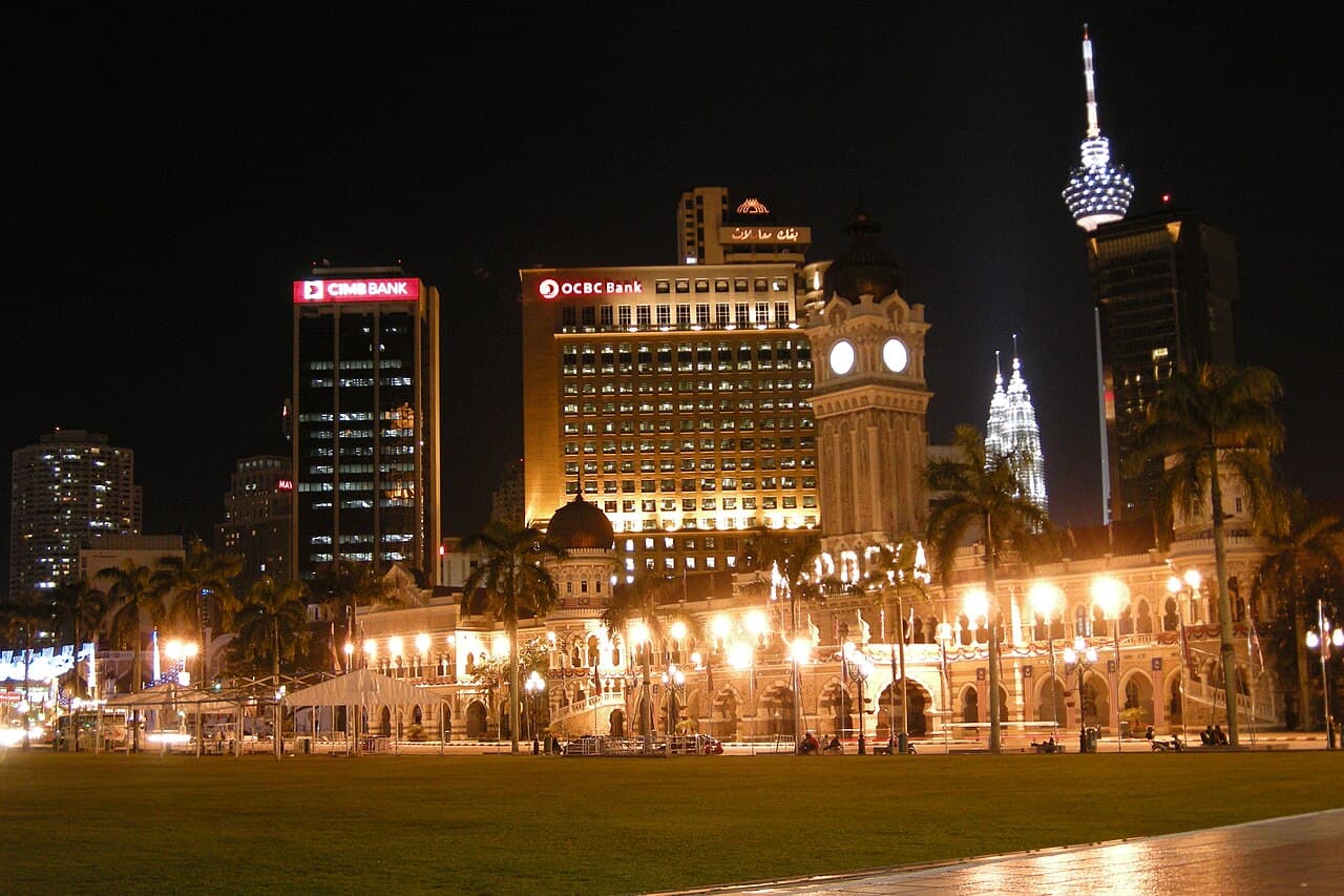
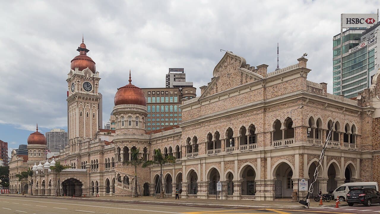
A short move from the confluence reaches Bangunan Sultan Abdul Samad and Merdeka Square. The restored building's official history explains that Kuala Lumpur became Selangor's administrative centre in 1880 and that the 1897 New Government Offices concentrated major departments. This institutional shift helps explain why monumental civic architecture grew beside the older commercial and river core. The river was not merely scenery behind the building; it was part of the geography through which the administrative city took shape. Walk around the public edges and compare the formal square-facing facade with the more infrastructural rear relationships of roads, river and bridges.
- Compare the ceremonial front with the river-facing urban fabric.
- Connect the 1880 administrative shift with the later 1897 offices.
- Check current BSAS access if you want interior interpretation.
05
Follow the corridor toward trade and craft
River of Life's heritage route connects the civic core with the National Textile Museum, Central Market and religious landmarks around the wider river corridor. Central Market's own history begins as a wet market in 1888 before its later art-and-craft use. Together, these sites show commercial adaptation: food supply, wholesale and street trade changed, while buildings found new public roles. Do not assume the present retail mix reproduces the nineteenth-century market. Instead, compare building reuse, street width and the movement between river crossings and shops. The dedicated heritage walk provides the practical sequence; this feature keeps attention on why trade clustered near water and administration.
- Distinguish the market building's history from its current retail role.
- Use the heritage route to identify nearby institutions.
- Read reuse as change, not as a perfect preservation of former commerce.
06
Understand what River of Life is trying to change
The River of Life programme was launched in 2011 and describes three linked components: river cleaning, beautification and land development. Its official story frames the river as an underused natural asset and aims to reconnect the city, waterways and communities. That description is an ambition and programme structure, not a guarantee that every stretch or feature matches a promotional rendering. The project page publishes current performance and water-quality information, which can change over time. Before visiting for a particular lighting, fountain or waterfront experience, check the current official site. On location, read new public space alongside flood control, transport and the older urban fabric.
- Separate cleaning, public-realm work and land development.
- Treat project targets and current conditions as different categories.
- Check live official information for specific waterfront features.
07
Make a short confluence-reading walk
Begin at a public view of the confluence and identify each river. Study Masjid Jamek's position, then cross toward the Merdeka civic core using the route open on the day. Compare Bangunan Sultan Abdul Samad's formal frontage with the river-side infrastructure, and finish toward Medan Pasar or Central Market if you want the trade connection. This is an editorial sequence, not an official timed tour. Check River of Life, mosque, BSAS and Central Market pages for current access or events. If a river path is diverted, preserve the questions and change the path; the intellectual route matters more than following an exact line.
- Identify both rivers before visiting individual landmarks.
- Compare worship, administration and trade as distinct urban functions.
- Use current official notices to revise the physical route.
Useful answers
Reader questions
Which two rivers meet in central Kuala Lumpur?
The Klang and Gombak rivers meet beside Masjid Jamek. DBKL's current planning material identifies this confluence area as the starting point of Kuala Lumpur's spatial development.
Sources: Dewan Bandaraya Kuala Lumpur; National Archives of MalaysiaIs the confluence the complete origin story of Kuala Lumpur?
No. It is a crucial geographic and planning anchor, but official accounts also point to mining, cultivation, infrastructure, leadership and multiple communities in the city's growth.
Sources: Dewan Bandaraya Kuala Lumpur; Jabatan Wilayah PersekutuanWhat is the River of Life project?
It is a government-led programme launched in 2011 with river cleaning, beautification and land-development components for the Klang and Gombak corridors. Current progress and conditions should be checked on its official site.
Sources: Jabatan Wilayah Persekutuan; Jabatan Wilayah PersekutuanCan I follow the river directly to all heritage stops?
Do not assume a continuous fixed path. Use the official heritage material as a thematic guide, then check current access, crossings and diversions for the confluence, mosque, civic complex and market area.
Sources: Jabatan Wilayah Persekutuan; Bangunan Sultan Abdul SamadRead the evidence
Sources and further reading
These sources support the relevant sections above. Plans and comparisons are editorial suggestions. Check operators for current arrangements.
- Kuala Lumpur Structure Plan 2040: Promoting City Development ↗Dewan Bandaraya Kuala Lumpur · Research date 14 September 2026
Official spatial-development account, early downtown concentration, confluence and later expansion.
- Our Story ↗Jabatan Wilayah Persekutuan · Research date 14 September 2026
River of Life background, river history, programme components, community goals and current-project framing.
- River of Life FAQs ↗Jabatan Wilayah Persekutuan · Research date 14 September 2026
2011 launch and official definitions of river cleaning, beautification and land-development components.
- Heritage Trails ↗Jabatan Wilayah Persekutuan · Research date 14 September 2026
Official heritage relationships among the river, civic buildings, textile museum, market and religious sites.
- Masjid Jamek Kuala Lumpur ↗National Archives of Malaysia · Research date 14 September 2026
Mosque's confluence location, foundation stone, opening date and architectural authorship.
- Masjid Jamek Sultan Abdul Samad ↗Jabatan Kemajuan Islam Malaysia · Research date 14 September 2026
Active mosque context, architectural influences, restoration history and current official identity.
- Bangunan Sultan Abdul Samad ↗Bangunan Sultan Abdul Samad · Research date 14 September 2026
1880 administrative shift, 1897 government offices, architecture, later uses and current visitor context.
- Central Market Kuala Lumpur ↗Central Market Sdn Bhd · Research date 14 September 2026
1888 wet-market origin, present cultural retail role and current visitor information.